

Earl was downgraded to a Tropical Storm late yesterday as it tracked northeast. The cyclone is currently moving directly northeast at 26 knots (48 kmh/30 mph). The latest satellite picture shows a resurgence of convection around the centre.
As can be seen from the latest satellite shot taken just a few minutes before posting, Earl is cutting a wide swath through the Canadian Maritimes and, even though landfall is only minutes away, Earl will remain a powerful cyclone as the centre moves through Nova Scotia and Prince Edward Island. It will become a post-tropical low after it crosses PEI and enters the Gulf of St Lawrence. Even then it will still be packing high winds.
The Canadian Hurricane Centre has issued a Tropical Storm Warning for the entire Nova Scotia coast, Prince Edward Island, the Magdalen Islands and New Brunswick from Fundy National Park to Fort Lawrence and from Shediac to Tidnish.
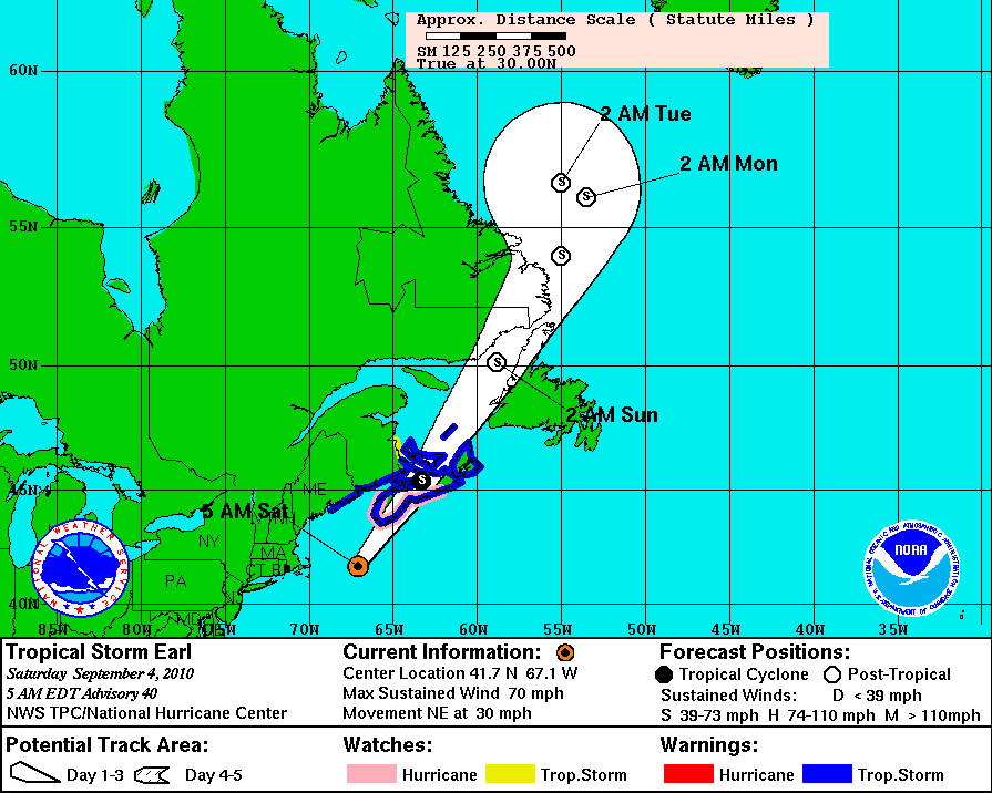
For those in western Nova Scotia and the South Shore, those warnings are now matter of fact as they are starting to get the effects of Earl directly. The east side of Earl will possess markedly stronger winds than the western semi-circle. This has to do with the forward motion of the storm. Expect initial winds of 60 knots (111 kmh/69 mph) with stronger gusts in some areas.
Halifax weather radar
Yarmouth Webcam (you might have to refresh this manually)
Lunenburg Webcam
Bedford Basin Webcam
Halifax Harbour Webcam (CBC)
Peggy's Cove webcam
Update: Earl made landfall just before 10 a.m. Nova Scotia time just east of Lockport N.S. The South Shore of NS is going to take the brunt of this one. Halifax is reporting harbour winds of 40 knots (74 kmh/46 mph).

No comments:
Post a Comment